


Key Takeaways
- This Route 66 Road Trip Guide covers roughly 2,400 miles (3,900 km) between Chicago and Santa Monica, crossing eight states and some of the most recognizable landscapes in the United States.
- Spring and fall are generally the most comfortable seasons for an American road trip Route 66 adventure, helping you avoid the most extreme desert heat and harsh Midwestern winter conditions.
- Allow around two to three weeks for a relaxed end-to-end journey. A faster trip is possible in 10–14 days, while shorter sections work well if your vacation time is limited.
- Plan fuel stops, accommodation, attractions, and offline maps before departure, particularly for rural and desert sections where services and mobile coverage can be more limited.
- Support independent diners, motels, museums, and shops along the way. These businesses help preserve the character and living heritage that make Route 66 distinctive.
- Set up a Ubigi eSIM before your trip for convenient mobile data when network coverage is available. Keep offline maps as a backup for remote areas.

Introduction
An American road trip Route 66 journey is one of the most iconic ways to cross the United States. Extending roughly 2,400 miles (3,900 km) between Chicago and Santa Monica, the historic highway passes through eight states, connecting major cities, small towns, deserts, plains, and mountains.
Along the way, historic motels, neon signs, roadside attractions, diners, museums, and preserved sections of pavement tell the story of 20th-century American travel.
The journey has additional significance in 2026, as Route 66 celebrates its centennial. Whether you have two to three weeks for an end-to-end journey or only enough time to explore one section, this Route 66 Road Trip Guide will help you plan your route, choose when to travel, and identify some of the essential stops.
What Is Route 66?
Often called the “Mother Road,” Route 66 was designated in 1926 as part of the original U.S. Highway System. The route connected Chicago with Southern California and became an important corridor for migration, commerce, tourism, and automobile travel.
The historic route passes through Illinois, Missouri, Kansas, Oklahoma, Texas, New Mexico, Arizona, and California. Although Route 66 was officially decommissioned in 1985, many historic alignments remain accessible today.
Historic Origins
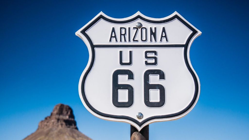
Route 66 brought together existing local, state, and national roads when it was designated in 1926. Early sections varied considerably in quality, and the entire route was not completely paved until 1938.
During the Great Depression, Route 66 became associated with westward migration, particularly from areas affected by economic hardship and the Dust Bowl. Businesses also developed alongside the highway to serve growing numbers of motorists.
Following World War II, automobile ownership and road tourism expanded rapidly. Interstate highways gradually replaced Route 66 as a major cross-country corridor, and the historic highway was officially decommissioned in 1985.
Cultural Legacy
Route 66 became much more than a transportation corridor. Songs, books, television, and films helped turn it into an international symbol of the American road trip.
Its roadside culture included neon-lit motels, family-run diners, gas stations, unusual attractions, and small museums. Many survive today, allowing travelers to experience elements of mid-century American road culture.
Preservation organizations, local communities, and public agencies continue working to protect historic sites and surviving sections of the highway. Numerous Route 66 resources are listed on the National Register of Historic Places, while some sections have received State or National Scenic Byway designations.
The highway’s 2026 centennial also highlights ongoing efforts to preserve its historic buildings, road sections, roadside businesses, and cultural heritage.
Road Trip Route 66 USA
A complete road trip Route 66 USA journey takes you from the Midwest through the Great Plains and Desert Southwest before reaching Southern California and the Pacific Coast. Allowing two to three weeks gives you more time to explore towns and attractions rather than simply covering mileage.
1. Midwestern Heartlands
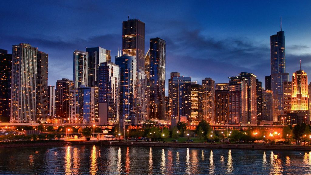
Begin in Chicago before traveling through Illinois toward Springfield and St. Louis. Illinois contains numerous historic alignments, roadside businesses, and landmarks connected with the early highway.
In Springfield, combine Route 66 attractions with sites associated with Abraham Lincoln. Farther north, Pontiac has museums, murals, and Route 66 heritage attractions.
Continue toward St. Louis, where the landscape begins transitioning from the Midwest toward the Ozarks. Historic diners, motor courts, and restored service stations make this section an ideal introduction to Route 66 culture.
2. Great Plains
Route 66 continues through Missouri, a short section of Kansas, and across Oklahoma before reaching Texas.
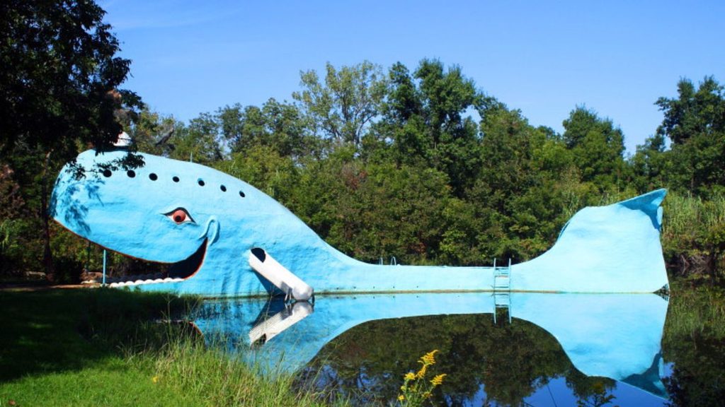
Stop at the Blue Whale of Catoosa, explore Route 66 heritage in Tulsa, and consider visiting the Oklahoma City National Memorial while passing through the state capital.
Kansas has only a short stretch of Route 66, making it easy to explore its historic communities before continuing into Oklahoma.
In Texas, Cadillac Ranch outside Amarillo is one of the route’s most recognizable roadside attractions. The Texas Panhandle also offers wide-open landscapes and classic Route 66 towns.
3. Desert Southwest
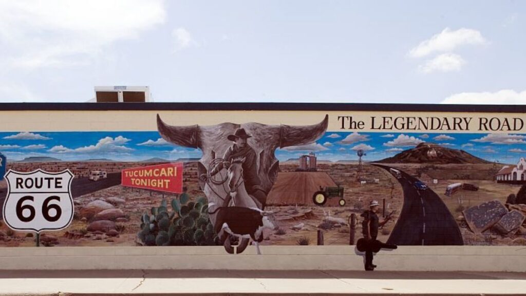
From Texas, continue into New Mexico and Arizona, where Route 66 passes through desert scenery, mesas, historic communities, and Native American lands.
Tucumcari is known for its vintage signs and motels, including the historic Blue Swallow Motel. Albuquerque combines Route 66 heritage with restaurants, museums, and nearby attractions.
In Arizona, Flagstaff is an excellent base for exploring the region. The Grand Canyon is not directly on Route 66, but it makes a popular detour from northern Arizona.
Continue through towns such as Williams and Kingman before following historic roads toward Oatman, known for its mining history and free-roaming burros.
4. California and the Pacific
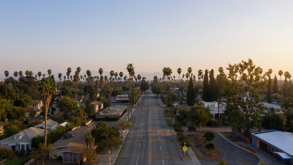
After crossing the Mojave Desert, Route 66 continues through communities including Barstow and San Bernardino before entering the Los Angeles metropolitan area.
Historic alignments eventually lead toward Santa Monica, where the pier has become the symbolic finish for many modern Route 66 road trips.
After days of desert roads, roadside attractions, and small towns, reaching the Pacific provides a memorable conclusion to the journey.
Essential Route Planning Details
Good planning is essential because Route 66 is no longer a continuously signed federal highway. Your trip will combine historic alignments, local roads, and modern highways.
Best Time to Travel Route 66
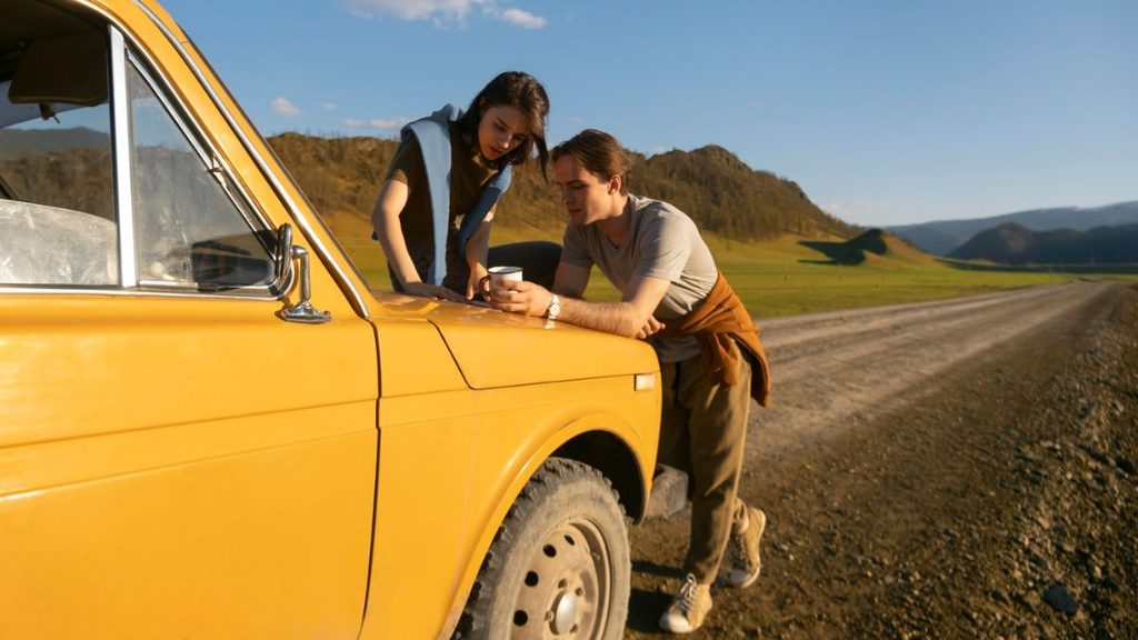
Spring and fall are generally the most comfortable periods for a full Route 66 journey. However, weather varies considerably across the route.
April and May can provide pleasant conditions across much of the Midwest, while September and October combine milder temperatures with autumn scenery. In the Southwest, spring and fall help you avoid the most intense summer heat.
Summer remains popular but can bring extreme temperatures in desert areas. Winter may mean snow, ice, or difficult driving conditions in parts of the Midwest and higher-elevation Southwest.
Always check forecasts and road conditions for individual destinations rather than relying on one forecast for the entire route.
How Long Does Route 66 Take?
Allow around two to three weeks for a comfortable end-to-end trip with time for attractions, museums, meals, and spontaneous stops.
A faster itinerary can be completed in approximately 10–14 days, but you will spend more time driving. If you have less time, consider concentrating on individual sections such as:
- Chicago to St. Louis
- Tulsa to Amarillo
- Albuquerque to Flagstaff
- Flagstaff to Santa Monica
Build some flexibility into your itinerary for weather, road closures, national park detours, and unexpected discoveries.
Navigation and Driving
Since Route 66 was decommissioned in 1985, some original alignments have disappeared, been bypassed, or are difficult to identify.
Use a combination of current GPS navigation, a dedicated Route 66 guide, offline maps, and historic road signs. A paper map provides a useful additional backup.
Mark important fuel stations, accommodation, restaurants, and service points before entering remote areas. Carry drinking water and basic emergency supplies, and make sure your vehicle is in good condition before long desert stretches.
Living Heritage Along Route 66
Route 66 remains special because many of its historic businesses and communities are still part of the journey. Supporting them can also contribute to ongoing preservation efforts.
Neon Motels
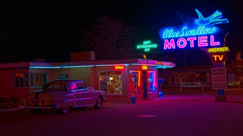
For travelers planning a Route 66 America trip, vintage motels are among the highway’s most distinctive experiences. Properties such as the Blue Swallow Motel in Tucumcari preserve characteristic roadside architecture and neon signage.
Popular historic properties can fill quickly, particularly during events and busy travel periods, so reserve important overnight stops in advance.
Historic Diners and Roadside Food
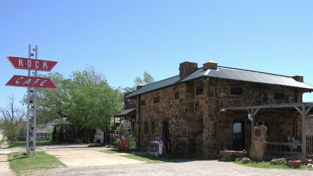
Classic diners and independent restaurants are another important part of Route 66 culture. Rather than relying entirely on chain restaurants, stop at locally owned businesses and try regional specialties.
Well-known Route 66 food stops include Cozy Dog Drive In in Springfield, Illinois, Rock Café in Stroud, Oklahoma, and Delgadillo’s Snow Cap in Seligman, Arizona.
Opening days and hours can change, so check current information before making a long detour for a particular restaurant.
Small Communities
Towns such as Pontiac, Tucumcari, Santa Rosa, Williams, and Seligman help preserve Route 66 through museums, murals, restored gas stations, shops, and historic accommodation.
Take time to leave the main highway and explore these communities on foot. Spending money at independent businesses helps support the places that keep Route 66’s heritage visible for future travelers.
The National Park Service and its partners have supported preservation efforts along the Route 66 corridor, while the 2026 Route 66 Centennial brings renewed attention to the highway’s historic places and communities.
Travel Tips for Navigating Route 66

Travel Connectivity with Ubigi eSIM
Staying connected can make a Route 66 road trip easier, particularly when you need maps, weather information, accommodation details, or updated travel information.
With a Ubigi eSIM for the USA, you can set up your mobile data before departure instead of searching for a local SIM card after arrival. Install the eSIM on a compatible, unlocked device, choose a suitable USA data plan, and you can be ready to connect to a supported network when your plan becomes active.
Mobile data is useful for checking traffic, finding gas stations, confirming motel reservations, navigating between historic Route 66 alignments, and sharing photos. You can also manage your Ubigi service directly from the app and purchase additional data when needed.
However, Route 66 crosses remote rural and desert areas where mobile coverage can vary. Download offline maps before your journey and save accommodation details, emergency numbers, planned fuel stops, and important addresses.
Combining a Ubigi eSIM with offline navigation gives you greater flexibility throughout your Route 66 journey without relying entirely on motel, restaurant, or public Wi-Fi.
Additional Road Trip Tips
Book popular historic motels and important accommodation in advance, particularly during peak travel periods and special Route 66 events.
Carry water and snacks during desert sections and avoid letting your fuel level become too low. Check road conditions before using historic alignments, as some sections may be rough or unsuitable for certain vehicles.
Most importantly, leave room in your schedule. Route 66 is as much about unexpected roadside attractions, conversations, and small towns as it is about reaching Santa Monica.
Conclusion
A Route 66 road trip combines American history, changing landscapes, roadside culture, and the freedom of exploring at your own pace.
From Chicago’s urban streets to Midwestern towns, Texas plains, Southwestern deserts, and the Pacific Coast, every section offers something different. Allow enough time to stop at historic motels, independent diners, museums, and small communities rather than simply driving from one major city to another.
The Route 66 Centennial in 2026 makes this an especially significant year to discover the Mother Road and the communities preserving its legacy.
Prepare your route, accommodation, fuel stops, offline maps, and Ubigi eSIM before departure. With the practical details organized, you can focus on the experiences that have made Route 66 one of the world’s most recognizable road trips.

Frequently Asked Questions
What is Route 66 and why should I drive it?
Route 66 is a historic American highway connecting Chicago with Southern California. Although it was decommissioned in 1985, many sections remain driveable. Travelers come for its historic towns, roadside attractions, diners, motels, changing landscapes, and connection with American automobile culture.
How long does a full Route 66 road trip take?
Allow around two to three weeks for a relaxed journey. A faster trip can take approximately 10–14 days, while travelers with limited time can explore individual sections instead.
What vehicle is best for Route 66?
A reliable sedan or SUV is sufficient for most commonly traveled sections. Prioritize comfort, fuel efficiency, and adequate luggage space. Check conditions before attempting less-maintained historic alignments.
When is the best time to travel Route 66?
Spring and fall generally provide the most comfortable conditions. Summer can become extremely hot in the Southwest, while winter can bring snow and ice to the Midwest and higher elevations.
How do I plan accommodation and stops?
Choose your essential overnight destinations first and book popular historic properties in advance. Allow time between major stops for roadside attractions, museums, restaurants, and spontaneous discoveries.
Can I follow original Route 66 signs the whole way?
No. Route 66 is no longer a continuous federal highway, and some historic sections have disappeared or been bypassed. Use Route 66 guides, current navigation, historic road signs, and offline maps to follow accessible alignments.
How can I stay connected during a Route 66 road trip?
A Ubigi eSIM can provide convenient mobile data on supported networks for navigation, bookings, messaging, and travel information. Because coverage can vary in remote areas, combine your eSIM with downloaded offline maps and saved essential information.








 How to check eSIM compatibility
 How to check carrier unlocking